Friday 12 January
Today is my last look at the North Island as I make my way to the South Island. The shuttle bus arrived at 7.30am and arrived at the Wellington ferry terminal at 7.45. I had booked the 8.25 ferry which would arrive in time to catch the Tranz Coastal (train) from Picton to Christchurch. The ferry crossing takes 3 hours.
The "Arahura"
Arahura is a Māori word meaning "pathway to dawn".
The Arahura has been sailing across the Cook Strait since 1984 and can carry up to 550 passengers. There's a food court, a bar, and has extensive food and beverage facilities.
The onboard facilities are very good, with a cinema, lounge, and outside observation decks.
Ship Ahoy!
It was very windy as you can see. I love sitting outside and usually do, but I and other hardy souls made for indoors as the wind was icy and the chill factor seemed to seep into one's bones.
Marlborough Sounds
The Marlborough Sounds are an extensive network of sea-drowned valleys created by a combination of land subsidence and rising sea levels at the north of the South Island of New Zealand. According to Māori mythology, the sounds are the prows of the sunken waka (canoe) of Aoraki.
The main channels of the Marlborough Sounds have calm water and are popular for sailing. Cook Strait, however, is infamous for its strong currents and rough waters, especially when the wind is from the south or north. Because of this, some of the narrow channels closer to the Strait are dangerous.
How The Sounds Were Formed
The Marlborough Sounds is a network of fjiord-like waterways, sheltered by steep hills, most clad in native and timber forests. Geologists would describe the Sounds as ‘drowned valleys’, where in past millennia, the mountains sank in earth movements and the sea flooded into the valleys. Māori legend tells a more exotic story of their creation, how as Kupe wrestled with a giant octopus he grasped at the South Island for support, his fingers digging deep and carving out the waterways.
Tory Channel
Tory Channel is named after the "Tory", a pioneer ship that brought British colonists to Wellington in 1840. It lies to the south of Arapawa Island, separating it from the mainland and forms a substantial part of the ferry route between Wellington and Picton.
Queen Charlotte Sounds
Queen Charlotte Sound is the easternmost of the main sounds of the Marlborough Sounds, in New Zealand's South Island, and like the other sounds, is a drowned river valley.
The area was a base for whaling throughout the 19th and early 20th centuries, notably at Perano Head on Arapawa Island which lies to the east. Queen Charlotte Sound has calm water and is popular for sailing - a marked contrast to the notorious waters of Cook Strait.
The town of Picton, the northern terminus of the South Island's railway and State Highway networks, lies near the head of the Sound.
Picton
At the head of Queen Charlotte Sound is Picton, a quaint waterfront village - gateway to the South Island. Picton is the main link between the South and North Island, with scheduled ferry service over Cook Strait. I had an hour os so to spare before my train left and went for a stroll around the streets.
Dublin Street Roundabout
Having Irish ancestry, I just had to get a photo of this!
World War I Memorial
Overlooking the foreshore, the Sounds War Memorial was dedicated and unveiled in 1925. The inscription reads: "To Commemorate the Sounds Men who fell in the Great War 1914-1918", (21 names). Another eight names were added and a platform built around the memorial after World War II.
The Kiwis honour their soldiers with Remembrance Day (11 November) as well as Anzac Day (25 April), which is a national holiday.
Welcome to Picton
This sign is placed stragically along the walk from the ferry to the town.
The Tranz Coastal
The TranzCoastal train journey travels between Picton and Christchurch, departing Picton at 1.00pm and arriving Christchurch at 6.21pm. I fell asleep on the train and broke the side arm of my glasses. When going to the buffet car, my watch strap broke due to the train rocking wildly causing me to lose balance and hitting my arm on the wall of the carriage.
The Journey
The TranzCoastal travels through 22 tunnels and crosses 175 bridges. As on the TranzAlpine, the TranzCoastal includes an open air viewing carriage where all your senses are awakened with the clean, fresh, sea air. (The above photo is from Tranzscenic)
It was raining and foggy and we arrived 30 minutes late. The shuttle bus costs $5.00 and I arrived back at the YHA in Manchester Street. Wonderful staff at this YHA - they had placed a sign saying "Reserved for.. Room 2"
Tēnā koutou katoa
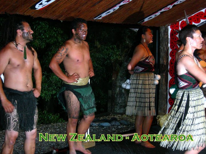
This is all about New Zealand - Aotearoa - and the time I spent there. Magical times, beautiful scenery, gushing geysers, thermal wonderlands. Hear about Waitangi Day, discover the meaning of the word "Aotearoa", see the Glaciers, read about hangis and Hakas, and visit the beautiful Bay of Islands. So come with me on a journey - a journey to The Land of The Long White Cloud.
Kia ora
CHRISTCHURCH EARTHQUAKE TRIBUTE 2011
Kia ora
Watch The Haka
Showing posts with label z Beaches and Coastlines. Show all posts
38. Wellington - Harbour Walk
Thursday 11 January
After riding on the cable car, I strolled along the waterfront of Wellington's magnificent harbour, which I thought much prettier than Auckland's.
Wellington Harbour
Academy Galleries
Founded in 1882, the Academy of Fine Arts is now housed on the ground floor of the architecturally stunning and heritage protected Wharf Offices Apartments Building in Queen's Wharf.
The Academy Galleries support New Zealand's emerging and established artists through the sale of New Zealand Art as well as fostering a national appreciation and pride of fine art produced by artists around the country.
A non-profit making private company, the Galleries is located at 1 Queens Wharf Lambton just a 2 minute walk from Downtown Wellington.
Frank Kitts Park - Climbing Lighthouse
The lighthouse was designed in the late 1980's by Mark Pennington.
Completed in the late 1980s, Frank Kitts Park on Jervois Quay in the central city, was one of the first areas of the waterfront to be developed. The design was heavily influenced by the annual street car race that ran through the area at that time.
The waterfront also bustles with a myriad of cafes, restaurants and bars. After your waterfront adventure relax with a cup of coffee or a meal. Sit back and take in the breathtaking views.
The Mast from the Wahine
The fore-mast is part of a memorial and is in Frank Kitts Park.
The Wahine was an Interislander ferry which sank on 10 April 1968. Of the 610 passengers and 123 crew on board, 51 people lost their lives.
Two violent storms merged over Wellington, creating a single extratropical cyclone storm - Cyclone Giselle hit as the Wahine was crossing Cook Strait Captain Hector Robertson entered Pencarrow Head but the Wahine hit the rocks on Barrett Reef. The radar no longer worked and winds were up to 160 km/h.
Further reading about the Wahine disaster.
Wellington Harbour
Wellington’s magnificent harbour is a lake-like expanse of sheltered water surrounded by hills, with a narrow entrance to the sea.
A raised rock platform (a legacy of the great 1855 earthquake) surrounds the harbour’s edge. Today much of this is obscured by roads. In other places it is interspersed with sandy beaches.
In Māori the harbour is Te Whanganui-a-Tara (the great harbour of Tara) and Pōneke is the Māori name for Wellington.
Light Balls & Boatsheds
In the rear is the Star Boating Club which was formed in 1856 and is believed to be one of the oldest surviving sports clubs in New Zealand.
William Chatfield, the Thorndon Village Architect, designed the current club building on iron rails in 1885. It was later moved to Jervois Quay and is now at the Taranaki St Wharf
These spherical "balls" of which there are 33 in total, are called light balls and were created not only to represent bollards but to also provide lighting features.
Kupe, with Wife and Priest
The imposing bronze Kupe Group Statue, occupying pride of place on Taranaki Street Wharf, was originally designed in 1939 by Christchurch sculptor William Threthewey for the 1940 New Zealand Centennial Exhibition held at Rongotai, Wellington.
It was originally created in plaster and finished with bronze paint. Following the exhibition, the statue sat for 40 years at the Wellington Railway Station and ten at the Wellington Show and Sports Centre before being stored at the Te Papa, the national museum in 1997, as a national treasure. The statue was cast in bronze in 1999 as a millenium project and unveiled on 4 March 2000 as a tribute to all who have come to these shores.
The sculpture features Kupe Raiatea, the great Māori explorer and discoverer of Wellington harbour, his wife Te Aparangi and tohunga Pekahourangi.
The plaque at the base reads:
Matahourua te waka, ko Kupe te tangata, ko Hine-te-aparangi te wahine.
Kupe Raiatea the Explorer.
His wife Hine-te-aparangi.
And Pekahourang the tohunga
Sight Aotearoa, New Zealand
from their canoe Matahourua.
Circa Theatre
The theatre was formed in 1976, by an innovative group of people committed to presenting theatre of the highest possible standard.
In 1994 Circa moved to its present purpose-built site on the waterfront. Grant Tilly, one of the original Circa members, worked as theatre consultant with Ampersand Architects Ltd.
Apart from the historic brick Westport Chambers facade facing the Museum Plaza all new construction is timberThe main auditorium can seat around 250. and an extra 100 in a smaller studio space.
Harbour Walk
Click on the blue markers for photo, you can also enlarge the map.
View Wellington in a larger map
After riding on the cable car, I strolled along the waterfront of Wellington's magnificent harbour, which I thought much prettier than Auckland's.
Wellington Harbour
Academy Galleries
Founded in 1882, the Academy of Fine Arts is now housed on the ground floor of the architecturally stunning and heritage protected Wharf Offices Apartments Building in Queen's Wharf.
The Academy Galleries support New Zealand's emerging and established artists through the sale of New Zealand Art as well as fostering a national appreciation and pride of fine art produced by artists around the country.
A non-profit making private company, the Galleries is located at 1 Queens Wharf Lambton just a 2 minute walk from Downtown Wellington.
Frank Kitts Park - Climbing Lighthouse
The lighthouse was designed in the late 1980's by Mark Pennington.
Completed in the late 1980s, Frank Kitts Park on Jervois Quay in the central city, was one of the first areas of the waterfront to be developed. The design was heavily influenced by the annual street car race that ran through the area at that time.
The waterfront also bustles with a myriad of cafes, restaurants and bars. After your waterfront adventure relax with a cup of coffee or a meal. Sit back and take in the breathtaking views.
The Mast from the Wahine
The fore-mast is part of a memorial and is in Frank Kitts Park.
The Wahine was an Interislander ferry which sank on 10 April 1968. Of the 610 passengers and 123 crew on board, 51 people lost their lives.
Two violent storms merged over Wellington, creating a single extratropical cyclone storm - Cyclone Giselle hit as the Wahine was crossing Cook Strait Captain Hector Robertson entered Pencarrow Head but the Wahine hit the rocks on Barrett Reef. The radar no longer worked and winds were up to 160 km/h.
Further reading about the Wahine disaster.
Wellington Harbour
Wellington’s magnificent harbour is a lake-like expanse of sheltered water surrounded by hills, with a narrow entrance to the sea.
A raised rock platform (a legacy of the great 1855 earthquake) surrounds the harbour’s edge. Today much of this is obscured by roads. In other places it is interspersed with sandy beaches.
In Māori the harbour is Te Whanganui-a-Tara (the great harbour of Tara) and Pōneke is the Māori name for Wellington.
Light Balls & Boatsheds
In the rear is the Star Boating Club which was formed in 1856 and is believed to be one of the oldest surviving sports clubs in New Zealand.
William Chatfield, the Thorndon Village Architect, designed the current club building on iron rails in 1885. It was later moved to Jervois Quay and is now at the Taranaki St Wharf
These spherical "balls" of which there are 33 in total, are called light balls and were created not only to represent bollards but to also provide lighting features.
Kupe, with Wife and Priest
The imposing bronze Kupe Group Statue, occupying pride of place on Taranaki Street Wharf, was originally designed in 1939 by Christchurch sculptor William Threthewey for the 1940 New Zealand Centennial Exhibition held at Rongotai, Wellington.
It was originally created in plaster and finished with bronze paint. Following the exhibition, the statue sat for 40 years at the Wellington Railway Station and ten at the Wellington Show and Sports Centre before being stored at the Te Papa, the national museum in 1997, as a national treasure. The statue was cast in bronze in 1999 as a millenium project and unveiled on 4 March 2000 as a tribute to all who have come to these shores.
The sculpture features Kupe Raiatea, the great Māori explorer and discoverer of Wellington harbour, his wife Te Aparangi and tohunga Pekahourangi.
The plaque at the base reads:
Matahourua te waka, ko Kupe te tangata, ko Hine-te-aparangi te wahine.
Kupe Raiatea the Explorer.
His wife Hine-te-aparangi.
And Pekahourang the tohunga
Sight Aotearoa, New Zealand
from their canoe Matahourua.
Circa Theatre
The theatre was formed in 1976, by an innovative group of people committed to presenting theatre of the highest possible standard.
In 1994 Circa moved to its present purpose-built site on the waterfront. Grant Tilly, one of the original Circa members, worked as theatre consultant with Ampersand Architects Ltd.
Apart from the historic brick Westport Chambers facade facing the Museum Plaza all new construction is timberThe main auditorium can seat around 250. and an extra 100 in a smaller studio space.
Harbour Walk
Click on the blue markers for photo, you can also enlarge the map.
View Wellington in a larger map
37. Wellington - Cable Car
Thursday 11 January
There were two things I really wanted to do - ride on the Cable Car and go to Te Papa Tongarewa.
Wellingnton Cable Car
The Wellington Cable Car is one of Wellington’s oldest & most popular tourist attractions.
The Wellington Cable Car is a funicular railway in Wellington New Zealand. It carries passengers between Lambton Quay the main shopping street and Kelburn a suburb in the hills overlooking the central cit, rising 120 m over a length of 612 m. It is widely recognised as a symbol of Wellington
The Cable Car has two cars, which start from opposite ends of the line and pass in the middle. They are attached to each other by a 30-mm diameter cable, supported by 120 rollers, which runs round a pulley at the top
Going Down - The Rails
The best view is in the front seat for an unobstructed view of what lies ahead, I had to stand to get these shots as people decided to stand in front of the seats.
Through The tunnel
Coming back down, looking ahead from the cable car.
Over the Harbour
You can read about the history of the cable car.
Wellington Harbour
You get magnificent views from the top of the Botanical Gardens. There's a restaurant and bistro (the bistro's cheaper) and I had coffee and cake ($7.50) on the balcony. The best spot is the round section outside. I met a Swiss banker called Stefan and another Swiss (forget his name), who was studying medecine in America. They were both very friendly and gentlemanly. I must say though, that that little Swiss banker was the daintiest chap I ever met!
Cable Car Station
This is where you alight from the cable car once you reach the top, although there are other "stations" along the way.
Wellington Botanic Gardens
The Wellington Botanic Garden features 25 hectares of unique landscape, protected native forest, conifers, specialised plant collections, colourful floral displays, and views over Wellington city.
It is classified as a Garden of National Significance by the Royal New Zealand Institute of Horticulture and is an Historic Places Trust Heritage Area.
You can enter from Tinakori Road, Glenmore Street, Salamanca Road, Upland Road or the popular Cable Car.
I chose the cable car - you get marvellous views.
Rooftops Over The Harbour
Can you imagine the wonderful views you'd have waking up here every morning? Lovely spot to live and good exercise walking up (and down) that hill!
There were two things I really wanted to do - ride on the Cable Car and go to Te Papa Tongarewa.
Wellingnton Cable Car
The Wellington Cable Car is one of Wellington’s oldest & most popular tourist attractions.
The Wellington Cable Car is a funicular railway in Wellington New Zealand. It carries passengers between Lambton Quay the main shopping street and Kelburn a suburb in the hills overlooking the central cit, rising 120 m over a length of 612 m. It is widely recognised as a symbol of Wellington
The Cable Car has two cars, which start from opposite ends of the line and pass in the middle. They are attached to each other by a 30-mm diameter cable, supported by 120 rollers, which runs round a pulley at the top
Going Down - The Rails
The best view is in the front seat for an unobstructed view of what lies ahead, I had to stand to get these shots as people decided to stand in front of the seats.
Through The tunnel
Coming back down, looking ahead from the cable car.
Over the Harbour
You can read about the history of the cable car.
Wellington Harbour
You get magnificent views from the top of the Botanical Gardens. There's a restaurant and bistro (the bistro's cheaper) and I had coffee and cake ($7.50) on the balcony. The best spot is the round section outside. I met a Swiss banker called Stefan and another Swiss (forget his name), who was studying medecine in America. They were both very friendly and gentlemanly. I must say though, that that little Swiss banker was the daintiest chap I ever met!
Cable Car Station
This is where you alight from the cable car once you reach the top, although there are other "stations" along the way.
Wellington Botanic Gardens
The Wellington Botanic Garden features 25 hectares of unique landscape, protected native forest, conifers, specialised plant collections, colourful floral displays, and views over Wellington city.
It is classified as a Garden of National Significance by the Royal New Zealand Institute of Horticulture and is an Historic Places Trust Heritage Area.
You can enter from Tinakori Road, Glenmore Street, Salamanca Road, Upland Road or the popular Cable Car.
I chose the cable car - you get marvellous views.
Rooftops Over The Harbour
Can you imagine the wonderful views you'd have waking up here every morning? Lovely spot to live and good exercise walking up (and down) that hill!
12. Bay of Islands - Russell
Thursday 4 January
Bay of Islands
Taken from the upstairs verandah of Pompallier House. See the people sitting in the garden relaxing? They were playing a game of croquet earlier and it was quite a rare thing to see.
Seacraft in the Bay of Islands
A close-up from the verandah.
Bay of Islands
Taken from the upstairs verandah of Pompallier House. See the people sitting in the garden relaxing? They were playing a game of croquet earlier and it was quite a rare thing to see.
Seacraft in the Bay of Islands
A close-up from the verandah.
9. Bay of Islands - Paihia Esplanade Walk
Wednesday 3 January
Paihia is known as the Jewel of the Bay of Islands. The tree is the Pohutukawa Tree, also called the New Zealand Christmas Tree, and is one of the most outstanding plants of the entire New Zealand flora. With beautiful bright crimson flowers it is tough and hardy and can be seen in profusion along the coastal areas.
The Jewel in the Crown
Paihia Visitor Information Centre
This beautiful old building houses the Visitor Information Centre and other retail shops and is located at the Wharf in Marsden Road. The helpful staff will help organise and book activities, transport and cruises. Set amid beautiful clear waters it's a real delight just to stroll down and around this lovely area.
Ducks Crossing
One of the signs I spotted on my walk - alas I became "delete" happy and lost a few photos. (Sigh)
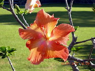
Paihia Hibiscus
Nodding in the breeze was this hibiscus along the waterfront.
Paihia is known as the Jewel of the Bay of Islands. The tree is the Pohutukawa Tree, also called the New Zealand Christmas Tree, and is one of the most outstanding plants of the entire New Zealand flora. With beautiful bright crimson flowers it is tough and hardy and can be seen in profusion along the coastal areas.
The Jewel in the Crown
Paihia Visitor Information Centre
This beautiful old building houses the Visitor Information Centre and other retail shops and is located at the Wharf in Marsden Road. The helpful staff will help organise and book activities, transport and cruises. Set amid beautiful clear waters it's a real delight just to stroll down and around this lovely area.
Ducks Crossing
One of the signs I spotted on my walk - alas I became "delete" happy and lost a few photos. (Sigh)
Paihia Hibiscus
Nodding in the breeze was this hibiscus along the waterfront.
10. Bay of Islands - Hole in the Rock Cruise
Thursday 4 January
Today I'm doing the Hole in the Rock cruise which departs from the Wharf at Paihia. There are two cruises daily - morning and afternoon. I chose the morning one which leaves at 9.00AM and gets back at 1.00PM as that would leave the rest of the afternoon free.
Motukokako Islands
The luxury catamaran the Tiger V, passes by the township of Russell (Kororareka) and several of the historic and culturally significant islands in the Bay, before heading out into the open sea.
Cape Brett Lighthouse
The 14-metre high Cape Brett Lighthouse stands at the entrance to the Bay of Islands and was built in 1908. An isolated settlement was established at Cape Brett in that year and included three identical houses for the lighthouse keepers and their families. Their duties included sending daily weather reports to the Meteorological Office.
For 70 years the lighthouse was staffed. In 1978, a smaller automated light was installed and with this automation came the end of the settlement.
We cruised past the Cape Brett Lighthouse, before arriving at the stunning Motukokako Island, home of the majestic Hole in the Rock.
Motukokako Island (Hole in the Rock)
At the outermost limits of the Bay of Islands, Motukokako Island, also known as Piercy Island, features a large geological fault that has created a sea arch large enough for tour boats to pass through when the weather is good enough.
Piercy Island was named by Captain James Cook, who also named the nearby peninsula Cape Brett, both after Rear Admiral Sir Piercy Brett, then a Lord of the Admiralty. It is called Motukokako in Māori.
The 210 foot hole at sea level was created over centuries by wind and waves making it one of the most naturally beautiful sites in New Zealand.
Today the island is of geological interest because of certain exposed rocks, as well as being a tourist attraction.
Going through the "Hole"
As we neared the dramatic Hole in the Rock our Skipper said over the loudspeaker the weather was too rough and the new boat we were on was too big to fit through and we wouldn't be able to go through the hole. I was so disappointed and so, I know, were the other passengers. The Skipper tried a second time to go through but with the same result and said he was sorry but he'd have to turn around and give it a miss. The disappointment was palpable.
Then he said he was only joking and we would be going through - seems this Cap'n has a good sense of humour and likes to have his little joke - it certainly caused a lot of fun and we appreciated even more the awesomeness of going under that majestic hole.
As we ventured into the dramatic Hole in the Rock – we held our breath in anticipation as the skipper navigated through the narrow space and admired the rock walls which soared above us. If you're on the top deck watch out for water drops!
On the Tiger V
Otehei Bay on Urupukapuka Island
Urupukapuka is the largest island in the Bay of Islands and is historically important with a rich archaeological landscape. A total of 66 archaeological sites have already been identified on the 208ha island. Most date from hundreds of years of Maori settlement prior to European arrival.
Today it is a recreational reserve. The Zane Grey Café does very good lunches - I had fish'n'chips and a glass of wine. It is a lovely relxaing place to unwind on the golden beach - the water was so clean and so clear, and you can also camp there.
Did you know that the Zane Grey Café/Resort was opnce home to the famous American adventurer and writer Zane Grey?
Urupukapuka Island is the largest of over 140 islands in the Bay, and is steeped in both Māori and European history. Urupukapuka has an area of 580 acres and was vested by the Crown as a recreational reserve in 1970. And as such, Urupukapuka is the only island in the Bay readily accessible to the public.
Fullers Ferries
Mapping Route
The last two photos aren't mine, they're from Fullers as I didn't think to photograph the boat and I lost my copy of the map route.
Today I'm doing the Hole in the Rock cruise which departs from the Wharf at Paihia. There are two cruises daily - morning and afternoon. I chose the morning one which leaves at 9.00AM and gets back at 1.00PM as that would leave the rest of the afternoon free.
Motukokako Islands
The luxury catamaran the Tiger V, passes by the township of Russell (Kororareka) and several of the historic and culturally significant islands in the Bay, before heading out into the open sea.
Cape Brett Lighthouse
The 14-metre high Cape Brett Lighthouse stands at the entrance to the Bay of Islands and was built in 1908. An isolated settlement was established at Cape Brett in that year and included three identical houses for the lighthouse keepers and their families. Their duties included sending daily weather reports to the Meteorological Office.
For 70 years the lighthouse was staffed. In 1978, a smaller automated light was installed and with this automation came the end of the settlement.
We cruised past the Cape Brett Lighthouse, before arriving at the stunning Motukokako Island, home of the majestic Hole in the Rock.
Motukokako Island (Hole in the Rock)
At the outermost limits of the Bay of Islands, Motukokako Island, also known as Piercy Island, features a large geological fault that has created a sea arch large enough for tour boats to pass through when the weather is good enough.
Piercy Island was named by Captain James Cook, who also named the nearby peninsula Cape Brett, both after Rear Admiral Sir Piercy Brett, then a Lord of the Admiralty. It is called Motukokako in Māori.
The 210 foot hole at sea level was created over centuries by wind and waves making it one of the most naturally beautiful sites in New Zealand.
Today the island is of geological interest because of certain exposed rocks, as well as being a tourist attraction.
Going through the "Hole"
As we neared the dramatic Hole in the Rock our Skipper said over the loudspeaker the weather was too rough and the new boat we were on was too big to fit through and we wouldn't be able to go through the hole. I was so disappointed and so, I know, were the other passengers. The Skipper tried a second time to go through but with the same result and said he was sorry but he'd have to turn around and give it a miss. The disappointment was palpable.
Then he said he was only joking and we would be going through - seems this Cap'n has a good sense of humour and likes to have his little joke - it certainly caused a lot of fun and we appreciated even more the awesomeness of going under that majestic hole.
As we ventured into the dramatic Hole in the Rock – we held our breath in anticipation as the skipper navigated through the narrow space and admired the rock walls which soared above us. If you're on the top deck watch out for water drops!
On the Tiger V
Otehei Bay on Urupukapuka Island
Urupukapuka is the largest island in the Bay of Islands and is historically important with a rich archaeological landscape. A total of 66 archaeological sites have already been identified on the 208ha island. Most date from hundreds of years of Maori settlement prior to European arrival.
Today it is a recreational reserve. The Zane Grey Café does very good lunches - I had fish'n'chips and a glass of wine. It is a lovely relxaing place to unwind on the golden beach - the water was so clean and so clear, and you can also camp there.
Did you know that the Zane Grey Café/Resort was opnce home to the famous American adventurer and writer Zane Grey?
Urupukapuka Island is the largest of over 140 islands in the Bay, and is steeped in both Māori and European history. Urupukapuka has an area of 580 acres and was vested by the Crown as a recreational reserve in 1970. And as such, Urupukapuka is the only island in the Bay readily accessible to the public.
Fullers Ferries
Mapping Route
The last two photos aren't mine, they're from Fullers as I didn't think to photograph the boat and I lost my copy of the map route.
7. Bay of Islands - Te Ti Bay, Paihia
Wednesday 3 January
Beautiful Te Ti Bay
The broad sweep of Te Ti Bay is Paihia’s most popular recreation beach and a variety of activities are here. It is fantastic for picnics, swimming, sunbathing, surfing, water skiing, fishing, kite surfing or wind surfing.
At the northern end of the beach you will pass Te Ti Marae on left. It was to this marae that Maori chiefs retired for the night to consider the Treaty of Waitangi before deciding to sign it at Waitangi on 6 February 1840.
Paihia’s main boat launching ramp is on your left at the northern end of the bridge. In summer it is a bustling scene from before dawn as fishing enthusiasts launch their craft.
Paihia Click on blue marker for photo
View My Saved Places in a larger map
Click on the blue marker for a photo. You can also enlarge the map.
Beautiful Te Ti Bay
The broad sweep of Te Ti Bay is Paihia’s most popular recreation beach and a variety of activities are here. It is fantastic for picnics, swimming, sunbathing, surfing, water skiing, fishing, kite surfing or wind surfing.
At the northern end of the beach you will pass Te Ti Marae on left. It was to this marae that Maori chiefs retired for the night to consider the Treaty of Waitangi before deciding to sign it at Waitangi on 6 February 1840.
Paihia’s main boat launching ramp is on your left at the northern end of the bridge. In summer it is a bustling scene from before dawn as fishing enthusiasts launch their craft.
Paihia Click on blue marker for photo
View My Saved Places in a larger map
Click on the blue marker for a photo. You can also enlarge the map.
5. Bay of Islands - Opo the Gay Dolphin
Wednesday 3 January
Opononi at Hokianga Harbour was our next stop, and here in the small visitor's information centre, we heard the tale of Opo the gay dolphin and watched a black and white video from 1955. I have searched Youtube but have been unsuccessful in finding it, so I will tell you the story.
Edited: Please note, the video is finally available on youtube. I have uploaded and added it to this post. You will find it near the end of this post after the story of Opo. I hope you enjoy the film as much as I did when I saw it.
The Story of Opo
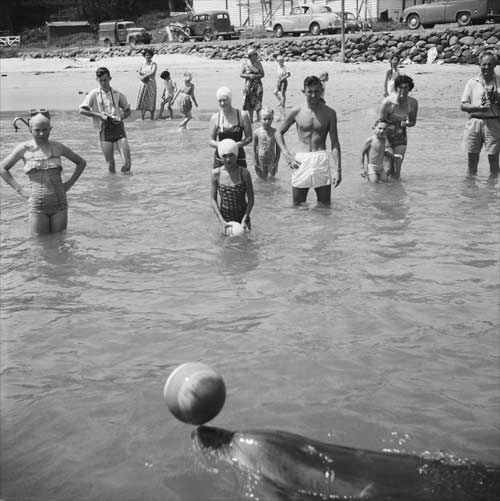
In the early summer of 1955, a lone bottle-nose dolphin swam into the Hokianga Harbour and started reacting with humans. Known as Opo, she became a favourite, first of the local community, then of its holiday-making visitors, and finally of the whole nation.
She reacted well with most everyone she came in contact, and especially with thirteen-year old Jill Baker, whose parents ran the nearby tearooms. Opo and the girl formed a very strong bond; Opo would tow Jill around the bay, and the girl would teach her tricks. Opo was especially careful and gentle when she was around small children. She loved children but seemed to know how fragile they were.
Very few local Maori played with Opo. They believed Opo was a taniwha, a messenger sent by Kupe back to his point of departure for Hawaiki. Dolphins have also figured in Western mythology, from the time of the Greek gods, as creatures friendly to humans. So in Opononi, Polynesian and European mythology came together to form a fabric that was a uniquely New Zealand one.
Above: Opo
Once the first newspaper articles and photos appeared in December 1955, Opononi became a magnet for holidaymakers wanting to see her. Hordes travelled by car or bus along dusty, unsealed roads to stay in the camping ground or the hotel, both of which quickly became booked out.
As thousands of visitors started to arrive at Opononi, she put on a show for them at the beach there almost every day, making some people scared for her safety: they thought such extreme interaction with humans would harm her. In response, the government passed a law limiting human interaction with her. But not everyone welcomed this law. Fishermen blamed Opo for their empty nets, others saw the law, which protected all dolphins in the Hokianga harbour, as a threat to the supremacy of man over nature.
Above: Welcome to Opononi sign, 1956
The day after the law was passed, Opo was found dead. During the night, a fisherman had blown her up with gelignite. The whole nation was devastated. The local community gave her a public funeral, and erected a statue of her in remembrance of her loving spirit.
Opo's memorial statue sculpted by Russell Clark.
Opo, The Hokianga Dolphin
This is the video we were shown in Opononi, which at the time was unavailable for uploading. Remember this footage is from 1955/1956 so expect a few quirks. Enjoy!
Read this eye-witness account by Piwai Toi. Ehare te toka i Akiha he toka whitinga ra tena, ko te toka o Mapuna, ko te ripo akake e kitea.
Below: Click on blue marker for photo
View West Coast New Zealand in a larger map
Opononi at Hokianga Harbour was our next stop, and here in the small visitor's information centre, we heard the tale of Opo the gay dolphin and watched a black and white video from 1955. I have searched Youtube but have been unsuccessful in finding it, so I will tell you the story.
Edited: Please note, the video is finally available on youtube. I have uploaded and added it to this post. You will find it near the end of this post after the story of Opo. I hope you enjoy the film as much as I did when I saw it.
The Story of Opo
In the early summer of 1955, a lone bottle-nose dolphin swam into the Hokianga Harbour and started reacting with humans. Known as Opo, she became a favourite, first of the local community, then of its holiday-making visitors, and finally of the whole nation.
She reacted well with most everyone she came in contact, and especially with thirteen-year old Jill Baker, whose parents ran the nearby tearooms. Opo and the girl formed a very strong bond; Opo would tow Jill around the bay, and the girl would teach her tricks. Opo was especially careful and gentle when she was around small children. She loved children but seemed to know how fragile they were.
Very few local Maori played with Opo. They believed Opo was a taniwha, a messenger sent by Kupe back to his point of departure for Hawaiki. Dolphins have also figured in Western mythology, from the time of the Greek gods, as creatures friendly to humans. So in Opononi, Polynesian and European mythology came together to form a fabric that was a uniquely New Zealand one.
Above: Opo
Once the first newspaper articles and photos appeared in December 1955, Opononi became a magnet for holidaymakers wanting to see her. Hordes travelled by car or bus along dusty, unsealed roads to stay in the camping ground or the hotel, both of which quickly became booked out.
As thousands of visitors started to arrive at Opononi, she put on a show for them at the beach there almost every day, making some people scared for her safety: they thought such extreme interaction with humans would harm her. In response, the government passed a law limiting human interaction with her. But not everyone welcomed this law. Fishermen blamed Opo for their empty nets, others saw the law, which protected all dolphins in the Hokianga harbour, as a threat to the supremacy of man over nature.
Above: Welcome to Opononi sign, 1956
The day after the law was passed, Opo was found dead. During the night, a fisherman had blown her up with gelignite. The whole nation was devastated. The local community gave her a public funeral, and erected a statue of her in remembrance of her loving spirit.
Opo's memorial statue sculpted by Russell Clark.
Opo, The Hokianga Dolphin
This is the video we were shown in Opononi, which at the time was unavailable for uploading. Remember this footage is from 1955/1956 so expect a few quirks. Enjoy!
Read this eye-witness account by Piwai Toi. Ehare te toka i Akiha he toka whitinga ra tena, ko te toka o Mapuna, ko te ripo akake e kitea.
Below: Click on blue marker for photo
View West Coast New Zealand in a larger map
Subscribe to:
Posts (Atom)