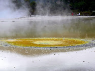
Today I'm doing the Hole in the Rock cruise which departs from the Wharf at Paihia. There are two cruises daily - morning and afternoon. I chose the morning one which leaves at 9.00AM and gets back at 1.00PM as that would leave the rest of the afternoon free.
Motukokako Islands

The luxury catamaran the Tiger V, passes by the township of Russell (Kororareka) and several of the historic and culturally significant islands in the Bay, before heading out into the open sea.
Cape Brett Lighthouse

The 14-metre high Cape Brett Lighthouse stands at the entrance to the Bay of Islands and was built in 1908. An isolated settlement was established at Cape Brett in that year and included three identical houses for the lighthouse keepers and their families. Their duties included sending daily weather reports to the Meteorological Office.
For 70 years the lighthouse was staffed. In 1978, a smaller automated light was installed and with this automation came the end of the settlement.
We cruised past the Cape Brett Lighthouse, before arriving at the stunning Motukokako Island, home of the majestic Hole in the Rock.
Motukokako Island (Hole in the Rock)

At the outermost limits of the Bay of Islands, Motukokako Island, also known as Piercy Island, features a large geological fault that has created a sea arch large enough for tour boats to pass through when the weather is good enough.
Piercy Island was named by Captain James Cook, who also named the nearby peninsula Cape Brett, both after Rear Admiral Sir Piercy Brett, then a Lord of the Admiralty. It is called Motukokako in Māori.
The 210 foot hole at sea level was created over centuries by wind and waves making it one of the most naturally beautiful sites in New Zealand.
Today the island is of geological interest because of certain exposed rocks, as well as being a tourist attraction.
Going through the "Hole"

As we neared the dramatic Hole in the Rock our Skipper said over the loudspeaker the weather was too rough and the new boat we were on was too big to fit through and we wouldn't be able to go through the hole. I was so disappointed and so, I know, were the other passengers. The Skipper tried a second time to go through but with the same result and said he was sorry but he'd have to turn around and give it a miss. The disappointment was palpable.
Then he said he was only joking and we would be going through - seems this Cap'n has a good sense of humour and likes to have his little joke - it certainly caused a lot of fun and we appreciated even more the awesomeness of going under that majestic hole.
As we ventured into the dramatic Hole in the Rock – we held our breath in anticipation as the skipper navigated through the narrow space and admired the rock walls which soared above us. If you're on the top deck watch out for water drops!
On the Tiger V

Otehei Bay on Urupukapuka Island

Urupukapuka is the largest island in the Bay of Islands and is historically important with a rich archaeological landscape. A total of 66 archaeological sites have already been identified on the 208ha island. Most date from hundreds of years of Maori settlement prior to European arrival.
Today it is a recreational reserve. The Zane Grey Café does very good lunches - I had fish'n'chips and a glass of wine. It is a lovely relxaing place to unwind on the golden beach - the water was so clean and so clear, and you can also camp there.
Did you know that the Zane Grey Café/Resort was opnce home to the famous American adventurer and writer Zane Grey?
Urupukapuka Island is the largest of over 140 islands in the Bay, and is steeped in both Māori and European history. Urupukapuka has an area of 580 acres and was vested by the Crown as a recreational reserve in 1970. And as such, Urupukapuka is the only island in the Bay readily accessible to the public.
Fullers Ferries

Mapping Route

The last two photos aren't mine, they're from Fullers as I didn't think to photograph the boat and I lost my copy of the map route.


No comments:
Post a Comment