Pages

New Zealand - Aotearoa by BlossomFlowerGirl

New Zealand Time

Aotearoa Snapshots

Click on Flag or Select Your Language to Translate

ArabicChinese (Simplified)DutchEnglishFrenchGermanHindiIndonesianItalianJapanesePortugueseRussianSpanishTurkishUrduBengaliNepali

Tēnā koutou katoa

This is all about New Zealand - Aotearoa - and the time I spent there. Magical times, beautiful scenery, gushing geysers, thermal wonderlands. Hear about Waitangi Day, discover the meaning of the word "Aotearoa", see the Glaciers, read about hangis and Hakas, and visit the beautiful Bay of Islands. So come with me on a journey - a journey to The Land of The Long White Cloud.
Kia ora


CHRISTCHURCH EARTHQUAKE TRIBUTE 2011


Watch The Haka

42. Greymouth - Accommodation

Saturday 13th January

Walked from the station to the YHA. Greymouth itself was a rather unappealing place - then again it was a Saturday and perhaps it may be more lively during the week. However, our accommodation more than made up for Greymouth's lack of beauty.

YHA Greymouth - Kainga-ra

The magnificant Kainga-ra is nestled amongst a bush-clad hill with plenty of trees and lovely gardens.

Originally a Marist Brothers residence in the 1930s, the building is full of character and ambience. It's on the side of a steep hill (it was very steep lugging a suitcase up the driveway!) and overlooks the sea. Kainga-ra YHA Greymouth is a beautiful old building and you get superb views sitting on the front verandah.


The Lounge and Hall area

The old chapel has been converted into a bedroom and the study into a lounge. There's a guitar and a piano which you are allowed to use. When I was here, the Christmas tree was still up and there were still some Christmas decorations. The lounge was done out in beautiful warm colours of deep red/maroon.


The Bedroom

The Tranz Alpine was part of my Magic pass and so I arrived at the hostel long before the Magic bus did with its load of passengers. Ergo I got to choose which bed I wanted - mine is the lower bunk on the left-hand side. That's my red cap on it. (All the other bits and pieces are mine too!)

41. Tranz Alpine & Arthur's Pass

Saturday 13 January

Today it's off to begin my South Island journey. The shuttle stopped at the YHA around 7.15am to take me and others to the Christchurch railway station. Weather was cool but pleasant. People were milling around taking photos of the train and excitement was high.


The Tranz Alpine travels between Christchurch and Greymouth, from one coast of New Zealand to the other. On the way you can see the fields of the Canterbury Plains and farmland, and the spectacular gorges and river valleys of the Waimakariri River.

Pretty much the whole way we had overcast skies, heavy cloud and rain, rain, rain! Which meant riding in the "viewing" platform (an open air carriage) was nigh on impossible. It rained the whole time we were on the train - except for about 20 minutes. But it really is a great trip. Strangely enough, a family member made this trip across the Southern Alps in winter this year (2009) and had blue, sunny skies!

The TranzAlpine

And of course I, along with countless others stood in front of the Tranz Alpine and "posed" - not a particularly attractive photo but, it's the only one I have. (It should perhaps be pointed out, that since my NZ trip I've lost heaps of weight!)☺
The train left on time at 8.15am and the fun begins.

Tranz Scenic offered 20% discount for YHA members when I was there, not sure if they still do. I can recommend the trip very highly it's one of the most breathtaking train rides you'll ever have. You get off at Arthur's Pass, everyone takes photos you have about 10-15 minutes before reboarding. I remember the train was longer than the platform.


Arthur's Pass

ARTHURS PASS is nestled amongst the Southern Alps in New Zealand's South Island, and marks part of the boundary between Westland and Canterbury, 140 km from Christchurch and 95 km from Greymouth. the train pulls in at 10:42am.

The pass lies in a saddle between the valleys of the Otira River, a tributary of the Taramakau, in the west and the Bealey River in the east. Arthur's Pass lies on the border of the Selwyn and Grey districts. Long before surveyor Arthur Dudley Dobson found his way over the pass in 1864, it was known to Māori hunting parties as a route between east and west.

You can see the heavy fog surrounding the station.

Arthur's Pass NP

The eastern side of Arthur's Pass National Park is characterised by wide, shingle-filled riverbeds and vast beech forests. The western side of the park, where wet weather is more common than dry, has deeply gorged rivers flowing through dense rainforest. Down the middle of 'the great divide' is an alpine dreamland of snow-covered peaks, glaciers and scree slopes.

View on left side


Southern Alps


Road Track and Mountains


Waimakariri River

The Waimakariri River flows for 151 km from the Southern Alps across the Canterbury Plains to the Pacific Ocean

It rises on the east of the Southern Alps 8 km s/w of Arthur's Pass. For much of its upper reaches the river's braided with wide shingle beds. As it nears the Canterbury Plains, it passes through a belt of mountains and is forced into a narrow canyon - Waimakariri Gorge, before reverting to its braided form for its passage across the plains. The river enters the Pacific north of Christchurch near Kaiapoi.


Misty Mountains

The train climbs into the Southern Alps before descending through lush beech rain forest to the West Coast town of Greymouth where we arrived at 12.45pm.

The trip is 223.8 kms long takes just four and a half hours. There are 16 tunnels, and 5 viaducts, the highest being the Staircase standing at 73 metres.

40. Marlborough Region & Picton

Friday 12 January

Today is my last look at the North Island as I make my way to the South Island. The shuttle bus arrived at 7.30am and arrived at the Wellington ferry terminal at 7.45. I had booked the 8.25 ferry which would arrive in time to catch the Tranz Coastal (train) from Picton to Christchurch. The ferry crossing takes 3 hours.


The "Arahura"
Arahura is a Māori word meaning "pathway to dawn".
The Arahura has been sailing across the Cook Strait since 1984 and can carry up to 550 passengers. There's a food court, a bar, and has extensive food and beverage facilities.

The onboard facilities are very good, with a cinema, lounge, and outside observation decks.

Ship Ahoy!
It was very windy as you can see. I love sitting outside and usually do, but I and other hardy souls made for indoors as the wind was icy and the chill factor seemed to seep into one's bones.


Marlborough Sounds
The Marlborough Sounds are an extensive network of sea-drowned valleys created by a combination of land subsidence and rising sea levels at the north of the South Island of New Zealand. According to Māori mythology, the sounds are the prows of the sunken waka (canoe) of Aoraki.

The main channels of the Marlborough Sounds have calm water and are popular for sailing. Cook Strait, however, is infamous for its strong currents and rough waters, especially when the wind is from the south or north. Because of this, some of the narrow channels closer to the Strait are dangerous.

How The Sounds Were Formed
The Marlborough Sounds is a network of fjiord-like waterways, sheltered by steep hills, most clad in native and timber forests. Geologists would describe the Sounds as ‘drowned valleys’, where in past millennia, the mountains sank in earth movements and the sea flooded into the valleys. Māori legend tells a more exotic story of their creation, how as Kupe wrestled with a giant octopus he grasped at the South Island for support, his fingers digging deep and carving out the waterways.

Tory Channel
Tory Channel is named after the "Tory", a pioneer ship that brought British colonists to Wellington in 1840. It lies to the south of Arapawa Island, separating it from the mainland and forms a substantial part of the ferry route between Wellington and Picton.

Queen Charlotte Sounds
Queen Charlotte Sound is the easternmost of the main sounds of the Marlborough Sounds, in New Zealand's South Island, and like the other sounds, is a drowned river valley.

The area was a base for whaling throughout the 19th and early 20th centuries, notably at Perano Head on Arapawa Island which lies to the east. Queen Charlotte Sound has calm water and is popular for sailing - a marked contrast to the notorious waters of Cook Strait.

The town of Picton, the northern terminus of the South Island's railway and State Highway networks, lies near the head of the Sound.


Picton
At the head of Queen Charlotte Sound is Picton, a quaint waterfront village - gateway to the South Island. Picton is the main link between the South and North Island, with scheduled ferry service over Cook Strait. I had an hour os so to spare before my train left and went for a stroll around the streets.


Dublin Street Roundabout
Having Irish ancestry, I just had to get a photo of this!


World War I Memorial
Overlooking the foreshore, the Sounds War Memorial was dedicated and unveiled in 1925. The inscription reads: "To Commemorate the Sounds Men who fell in the Great War 1914-1918", (21 names). Another eight names were added and a platform built around the memorial after World War II.

The Kiwis honour their soldiers with Remembrance Day (11 November) as well as Anzac Day (25 April), which is a national holiday.


Welcome to Picton
This sign is placed stragically along the walk from the ferry to the town.

The Tranz Coastal
The TranzCoastal train journey travels between Picton and Christchurch, departing Picton at 1.00pm and arriving Christchurch at 6.21pm. I fell asleep on the train and broke the side arm of my glasses. When going to the buffet car, my watch strap broke due to the train rocking wildly causing me to lose balance and hitting my arm on the wall of the carriage.

The Journey
The TranzCoastal travels through 22 tunnels and crosses 175 bridges. As on the TranzAlpine, the TranzCoastal includes an open air viewing carriage where all your senses are awakened with the clean, fresh, sea air. (The above photo is from Tranzscenic)


It was raining and foggy and we arrived 30 minutes late. The shuttle bus costs $5.00 and I arrived back at the YHA in Manchester Street. Wonderful staff at this YHA - they had placed a sign saying "Reserved for.. Room 2"

39. Wellington - Te Papa

Thursday 11 January


AS I strolled along the waterfront, my next stop was at Te Papa Tongawera - or as it is more commonly known, just Te Papa. It is New Zealand's national museum and has a huge array of Māori exhibits. It also had an entire floor devoted to LOTR!


Te Papa Tongawera

Ceremonial Chair


Waka


Basket

Necklace


Skirt


Sandals
Sandals woven from flax.


Marae


Te Hono ki Hawaiki
Te Hono ki Hawaiki is not a conventional meeting-house but, rather, a foreshortened structure at the rear of the open performance space or marae atea.


Corrugated HQ Holden
This 1974 Holden Kingswood was clad with corrugated iron by Jeff Thomson in 1991 and driven around for three years. It is one of the most popularly photographed items in the museum.

38. Wellington - Harbour Walk

Thursday 11 January


After riding on the cable car, I strolled along the waterfront of Wellington's magnificent harbour, which I thought much prettier than Auckland's.


Wellington Harbour


Academy Galleries

Founded in 1882, the Academy of Fine Arts is now housed on the ground floor of the architecturally stunning and heritage protected Wharf Offices Apartments Building in Queen's Wharf.

The Academy Galleries support New Zealand's emerging and established artists through the sale of New Zealand Art as well as fostering a national appreciation and pride of fine art produced by artists around the country.

A non-profit making private company, the Galleries is located at 1 Queens Wharf Lambton just a 2 minute walk from Downtown Wellington.

Frank Kitts Park - Climbing Lighthouse

The lighthouse was designed in the late 1980's by Mark Pennington.

Completed in the late 1980s, Frank Kitts Park on Jervois Quay in the central city, was one of the first areas of the waterfront to be developed. The design was heavily influenced by the annual street car race that ran through the area at that time.

The waterfront also bustles with a myriad of cafes, restaurants and bars. After your waterfront adventure relax with a cup of coffee or a meal. Sit back and take in the breathtaking views.


The Mast from the Wahine

The fore-mast is part of a memorial and is in Frank Kitts Park.

The Wahine was an Interislander ferry which sank on 10 April 1968. Of the 610 passengers and 123 crew on board, 51 people lost their lives.

Two violent storms merged over Wellington, creating a single extratropical cyclone storm - Cyclone Giselle hit as the Wahine was crossing Cook Strait Captain Hector Robertson entered Pencarrow Head but the Wahine hit the rocks on Barrett Reef. The radar no longer worked and winds were up to 160 km/h.

Further reading about the Wahine disaster.


Wellington Harbour

Wellington’s magnificent harbour is a lake-like expanse of sheltered water surrounded by hills, with a narrow entrance to the sea.

A raised rock platform (a legacy of the great 1855 earthquake) surrounds the harbour’s edge. Today much of this is obscured by roads. In other places it is interspersed with sandy beaches.

In Māori the harbour is Te Whanganui-a-Tara (the great harbour of Tara) and Pōneke is the Māori name for Wellington.


Light Balls & Boatsheds

In the rear is the Star Boating Club which was formed in 1856 and is believed to be one of the oldest surviving sports clubs in New Zealand.

William Chatfield, the Thorndon Village Architect, designed the current club building on iron rails in 1885. It was later moved to Jervois Quay and is now at the Taranaki St Wharf

These spherical "balls" of which there are 33 in total, are called light balls and were created not only to represent bollards but to also provide lighting features.


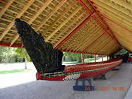
Kupe, with Wife and Priest

The imposing bronze Kupe Group Statue, occupying pride of place on Taranaki Street Wharf, was originally designed in 1939 by Christchurch sculptor William Threthewey for the 1940 New Zealand Centennial Exhibition held at Rongotai, Wellington.

It was originally created in plaster and finished with bronze paint. Following the exhibition, the statue sat for 40 years at the Wellington Railway Station and ten at the Wellington Show and Sports Centre before being stored at the Te Papa, the national museum in 1997, as a national treasure. The statue was cast in bronze in 1999 as a millenium project and unveiled on 4 March 2000 as a tribute to all who have come to these shores.

The sculpture features Kupe Raiatea, the great Māori explorer and discoverer of Wellington harbour, his wife Te Aparangi and tohunga Pekahourangi.

The plaque at the base reads:
Matahourua te waka, ko Kupe te tangata, ko Hine-te-aparangi te wahine.

Kupe Raiatea the Explorer.
His wife Hine-te-aparangi.
And Pekahourang the tohunga
Sight Aotearoa, New Zealand
from their canoe Matahourua.


Circa Theatre

The theatre was formed in 1976, by an innovative group of people committed to presenting theatre of the highest possible standard.

In 1994 Circa moved to its present purpose-built site on the waterfront. Grant Tilly, one of the original Circa members, worked as theatre consultant with Ampersand Architects Ltd.

Apart from the historic brick Westport Chambers facade facing the Museum Plaza all new construction is timberThe main auditorium can seat around 250. and an extra 100 in a smaller studio space.

Harbour Walk
Click on the blue markers for photo, you can also enlarge the map.

View Wellington in a larger map

37. Wellington - Cable Car

Thursday 11 January

There were two things I really wanted to do - ride on the Cable Car and go to Te Papa Tongarewa.

Wellingnton Cable Car

The Wellington Cable Car is one of Wellington’s oldest & most popular tourist attractions.

The Wellington Cable Car is a funicular railway in Wellington New Zealand. It carries passengers between Lambton Quay the main shopping street and Kelburn a suburb in the hills overlooking the central cit, rising 120 m over a length of 612 m. It is widely recognised as a symbol of Wellington

The Cable Car has two cars, which start from opposite ends of the line and pass in the middle. They are attached to each other by a 30-mm diameter cable, supported by 120 rollers, which runs round a pulley at the top


Going Down - The Rails

The best view is in the front seat for an unobstructed view of what lies ahead, I had to stand to get these shots as people decided to stand in front of the seats.


Through The tunnel

Coming back down, looking ahead from the cable car.

Over the Harbour

You can read about the history of the cable car.

Wellington Harbour

You get magnificent views from the top of the Botanical Gardens. There's a restaurant and bistro (the bistro's cheaper) and I had coffee and cake ($7.50) on the balcony. The best spot is the round section outside. I met a Swiss banker called Stefan and another Swiss (forget his name), who was studying medecine in America. They were both very friendly and gentlemanly. I must say though, that that little Swiss banker was the daintiest chap I ever met!

Cable Car Station

This is where you alight from the cable car once you reach the top, although there are other "stations" along the way.


Wellington Botanic Gardens

The Wellington Botanic Garden features 25 hectares of unique landscape, protected native forest, conifers, specialised plant collections, colourful floral displays, and views over Wellington city.

It is classified as a Garden of National Significance by the Royal New Zealand Institute of Horticulture and is an Historic Places Trust Heritage Area.

You can enter from Tinakori Road, Glenmore Street, Salamanca Road, Upland Road or the popular Cable Car.

I chose the cable car - you get marvellous views.


Rooftops Over The Harbour

Can you imagine the wonderful views you'd have waking up here every morning? Lovely spot to live and good exercise walking up (and down) that hill!

36. Wellington - City Walk

Thursday 11 January

After a lazy morning spent reading, I walked down Wakefield Street and bought a pegless clothesline from the Camping Store for $9.80 and found some lovely Christmas wrapping paper and postcards from Whitcoulls - made in England and only $3.00!

Wellington is becoming known as a centre for works of contemporary public art. Much of this reputation is based on the many sculptures commissioned from leading artists by the Wellington Sculpture Trust.

The Trust, active since 1984, raises funds and selects a wide variety of art for particular sites. It has the full support of the Wellington City Council which makes the sites available, assists with funding and assumes ownership after completion.


John Plimmer Statue

A man and his dog - John Plimmer (1812 – 1905) came from Shropshire on the ship Gertrude in 1841 & is called the Father of Wellington He was a member of the Wellington Provincial Council 1856-1857 the first Wellington Town Board 1863 & was on the Wellington City Council 1870-1871

His principal public service was the organisation of the Wellington & Manawatu Railway Company between 1880 & 1886

This bronze statue was created by Tom Tischler Ross Wilson Judy Alexander & Peter Kundycki in 1996 and is at the Plimmer Steps.


Bank of New Zealand

The Old Bank Building is one of Wellington's most famous landmarks - 2001 marked the hundred-year anniversary of this magnificent building - a testament as much to the architecture of John Turnbull & the original builders as it is to the incredible restoration work that has seen the Old Bank return to its former glory

A trip to the Old Bank is not just a retail thrill - it's a chance to experience a world of history and style that transcends the ages

It now houses the most exquisite fashion & beauty designs


Protoplasm

Created by Phil Price and located on the corner of Hunter Street and Lambton Quay, this interesting sculpture is one of several called Protoplasm.

Cable Car Lane

The Cable Car sculpture was created by Hugh Nicholson and Bob Sharpe in 2002, and is made of steel. It is located at Cable Car Lane.


Invisible City

Invisible City by Anton Parons was presented to the city with assistance from the Jack and Emma Griffin Charitable Trust and the Wellington City Council.

The stainless steel of this sculpture seems to glow with an inner light. The magnified Braille text suggests a message, but the artist chooses to deny us access, raising issues of communication in the contemporary world, and the difficult interface between the disabled and the rest of the community.

It was installed 2003.


Walk To The Water

This sculpture made of steel was created by Jerry Luhman and Bob Sharpe in 2000 and is at the corner of Grey Street & Lambton Quay.
Related Posts Plugin for WordPress, Blogger...